WE DEFINe PRECISION.
A world leader in precision sensors and technologies for position measurement and control.
A world leader in precision sensors and technologies for position measurement and control.
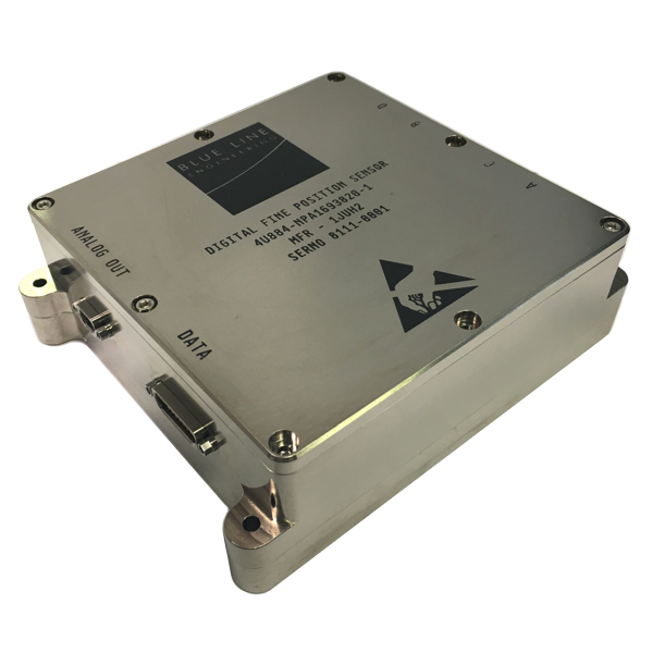
Our space-flight qualified differential sensors are built with radiation hardened components and approved materials, then are extensively tested to our customer’s requirements and mission specifications. SFQ sensor systems are shipped with comprehensive end-item documentation including: a requirement verification matrix, parts/materials/processes list (PMPL), as-built documentation, performance test history, and other quality records.

Blue Line’s new line of high-reliability differential measurement systems are designed to withstand the stresses of airborne and military environments. Our modular architecture and low size, weight, and power (SWaP) allows for flexible configurations & packaging in the tight confines of targeting pods and aircraft electro-optic sensor suites. These High-Reliability designs can be re-packaged to upgrade the performance of existing systems or delivered “bare”, without any enclosure.

The versatile DDS 620 is used in a wide range of applications from the lab to military aircraft. Designed as an affordable and timely way to achieve sub-nanometer resolution in the lab, industrial setting, or as a flight demonstrator, the DDS 620 allows Engineers and Integrators to prove system performance before moving to a longer lead time system. On the ground or in the air the DDS 620 saves time and money without sacrificing performance.
As partners in leading-edge scientific study and application, Blue Line works with customers ranging from government agencies and academic institutions to industrial and commercial aerospace companies. Whether we are providing high-quality custom products or acting as collaborative consultants to solve difficult engineering problems, we build and maintain close working relationships with our customers.
Our sensors are a critical technology enabling many cutting-edge missions, with over 65 space-flight systems delivered:

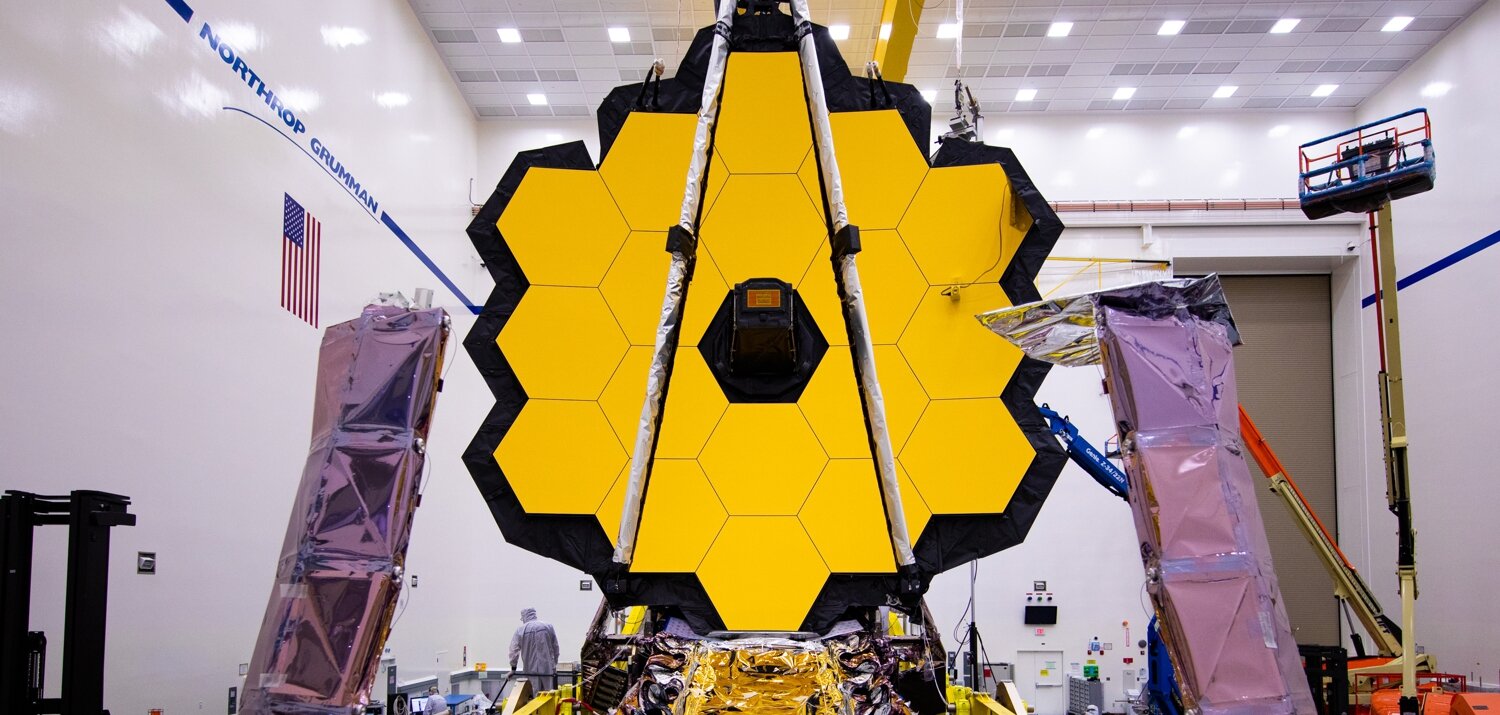
JWST - James Webb Space Telescope
THE JWST "will study every phase in the history of our Universe, ranging from the first luminous glows after the Big Bang, to the formation of solar systems capable of supporting life on planets like Earth, to the evolution of our own Solar System." JWST launched on December 25, 2021 and is now on-orbit at L2, approximately 1 Million miles from Earth.
TEMPO
"The TEMPO (Tropospheric Emissions: Monitoring Pollution) mission aims to answer this question with more detail and precision than ever before, by creating a revolutionary new dataset of atmospheric chemistry measurements from space. TEMPO will be the first space-based instrument to monitor major air pollutants across the North American continent every daylight hour at high spatial resolution." TEMPO is scheduled to launch in 2022
ICESat-2
“The Ice, Cloud, and Land Elevation Satellite-2, or ICESat-2, will measure the height of a changing Earth, one laser pulse at a time, 10,000 laser pulses a second. Launched September 15, 2018, ICESat-2 carries a photon-counting laser altimeter that will allow scientists to measure the elevation of ice sheets, glaciers, sea ice and more - all in unprecedented detail.”

GEMS - GEOSTATIONARY ENVIRONMENT MONITORING SPECTROMETER
Blue Line provided sensors to the Ball Aerospace built GEMS instrument which launched on February 19, 2020 aboard GEO-KOMPSAT 2B (GK 2B, Cheollian 2B).
NASA’s Aeronomy of Ice in the Mesosphere
The AIM satellite has been taking wide angle photos of noctilucent clouds (NLC), measuring their temperatures and chemical abundances, monitoring dusty aerosols, and counting meteoroids raining down on Earth since 2007.
Laser Communication Terminals for TESAT/ESA-EDRS
The European Space Agency (ESA) has developed a new family of Earth observation satellites called "Sentinels". Sentinels 1A & 1B provide day and night radar imagery, Sentinels 2A & 2B add high resolution optical imagery. Sentinels 3A & 3B focus on the oceans and atmosphere with an imaging spectrometer and altimeter. Data from the Sentinels is relayed from their low-earth, near-polar, sun-synchronous orbit via laser to EDRS-A and EDRS-C which have geosynchronous orbits.
Visit the Copernicus Mission homepage

LUCY
A trip to the Trojan’s of Jupiter, Blue Line’s sensors are part of the L’Ralph color visible imager. Lucy is scheduled to launch in 2021
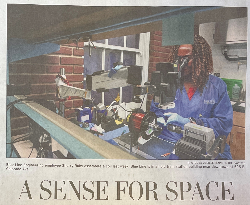
Blue Line Engineering is a Veteran-Owned Small Business (VOSB)